The way out hikes

Directions

Hikes near me: Bamford & Ladybower

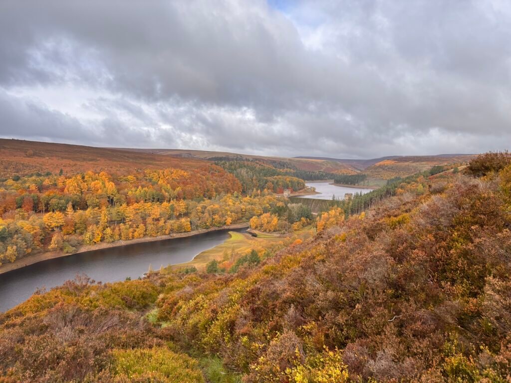
Hikes near me: Bamford & Ladybower 6.4 miles Distance Moderate Navigation burrito icon Burrito Challenge rating Route summary This hike combines gentle walking on well established paths with some more challenging moorland walking. The hike starts off gently with a walk along the east shore of Upper Derwent Reservoir. After this, you gain elevation and the great views over the Upper Derwent Valley open up.   Start and finish: Fairholmes car park Head NE towards the Derwent Dam from the car park. You will be on an unclassified road. As the road rounds a bend, look for a small footpath rising through a wooded area to your left (not the first trail path).   This path climbs gently to a bridleway. Turn left here and follow the track past the dam for approximately 3 km. The track is easy and this is a pretty walk on good ground.    You’re looking for a path on the right. If you reach a bridge, you’ve gone a little too far. You should see a very clear path. Take this and after around 40 yds look to the right of this, you should see a more faint path rising quite sharply through the trees in a southerly direction. This is the path you want.     After a short climb, you’ll go through a gate to enter the open access land. Continue rising diagonally. Continue SE with the boundary wall to your right. At around the km mark, you should cross a boundary wall. Continue on passing through another boundary wall.   Ignore the path you see to the left and continue SE past the cairns and through another boundary wall until you see a wide track heading off diagonally left and the outer corner of a field wall boundary.     Continue ahead on the track. You should have a small wooded area visible ahead of you slightly left. Enter the field to the right of this wooded area and take the path on the right to a gate.   Once through the gate, ignore the paths left and right and take the track forward with the boundary wall to your right.   This track will curve to the left and you’ll start to lose elevation. Follow the clear track down. Ignore when this track splits off to the left. Instead enter the field on your right and, keeping the wall to your left, handrail this to a gate.   Go through the gate and continue your descent back to the bridleway.   Turn right and head back towards the dam, where you can retrace your steps on the wooded path or take the steps down and return to the car park which has a takeaway cafe, picnic benches, and toilet facilities.

Hikes near me: Bamford & Ladybower Read More »
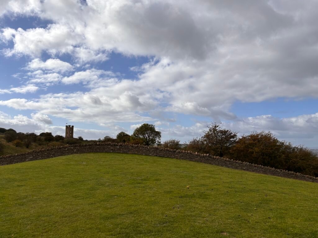
Hikes near me: Chipping Campden to Broadway

6 miles Distance Simple Navigation Biscuit Challenge rating Route summary This route is officially stage one of the Cotswolds Way National Trail which starts in Chipping Campden and ends in Bath. It’s an easy walk with great views and you can easily follow the official Cotswolds Way signs.   GPX  Start: Market Hall, Chipping Campden Finish: Broadway Village   Buses run into Chipping Campden from surrounding towns. There is free parking on the street and a paid car park in town, but be aware this is limited to 2 hours.    Start the route at the old market hall on High Street where you see the official Cotswold way plaque. Looking at the plaque, with the old market on your left – head south (to your right) and follow the road until you get to the Catholic Church on the corner.   Turn right at the church and head up the street until you reach a triangular junction with a large  wooden sign post – here head into Hoo Lane. Continue uphill here until you meet a lane (Kincombe Lane).    Turn left, cross the road and take the path enclosed with hedges on your right shortly. Go through the gate to Dover’s hill. Turn left into the meadow There is a topograph and a memorial stone in this meadow and some lovely views. It’s well worth a little lingering and there are some benches to sit on and enjoy the views on a clear day.    You’ll see a carpark, go through the gate into this and out the otherside, taking the path that runs parallel to the road on the left.   Pass through several fields keeping the hedge and road to your right and then exist via the gate in the corner right.    Cross the road on your left to the clear, wide path on the other side. This path runs behind the hedge. Keep on this path until you get to a stone stile.    Cross the stile and bear left and then right. The way here is very obvious. Keep on in this direction – passing through a gap in the wall and heading to a second wall.    Keep on in this direction across the field until you arrive at a road ( Buckle street).   Cross buckle street and cross the stile opposite into a field. Keep heading in the same direction and you will reach the outer edge of a picnic area.    To your right are a few stone steps with a memorial stone / Topograph (worth a little look). You need to head left though, through the picnic area.    This is a nice place to take a break if you have brought your own flash and snack with you and there are toilets here also.   From here – cross the road and turn right, following a broad rack that runs to the left of the road. You will soon reach a footpath through the edge of the woods. Follow this to emerge into a meadow.    Cross the meadow and bear left. You should now see Broadway tower up ahead – you’re heading towards this.   You can access the tower by going through the iron gate. At the tower, the views again are big.  There is one bench here if you require a little sit down. Or, if you are not ready to descend into Broadway yet – you can detour slightly here and continue past the tower to a cafe.    Once you’re ready, exit the tower through the same gate that you came in. Take a left and follow the path down with the hedge on your right and the tower on your left.   From here the way is very easy – just keep heading downhill in the same direction and follow Cotswolds Way signs to Broadway. You will emerge into a small lane between houses. From here, turn left and follow the road onto the High street where there are plenty of shops, pubs, and cafes.    Note, this is an A to B walk – so you’ll need to either turn around and retrace your steps to Chipping Campden  – making this a hoof of a walk (and uphill to the tower) Or, you can catch a bus back to Chipping Campden from outside the Lygon Arms. Download PDF

Hikes near me: Chipping Campden to Broadway Read More »

Hikes near me: Edge Hill

6.5 miles Distance Simple Navigation Biscuit Challenge rating Route summary Circular route overlooking the site of the Battle of Edge Hill. Pretty easy going, but boots are recommended due to the rocky woodland paths.  Start: Ratley, Banbury Finish: Ratley, Banbury GPX   Getting to the start of the walk   By bus Buses do run to Ratley from Leamington Spa, Banbury, and Stratford upon Avon   By Car You can park at Town Hill   About this walk Ratley From Town Hill, you want to head up Old road past the houses to meet the B4086. Cross the road and take the path slightly left of the junction. Take the steps down, sign posted the Centenary / Macmillan Way.   At the bottom of the steps, turn left, ignoring the kissing gate in front of you. Very shortly, again, take the rocky left hand path, following the Macmillan Way / public bridleway.   Keep on in this direction until you emerge at a road. Turn left here and very shortly cross the road to take the wide track. After a short while, you will come to a track between paddocks on your right. Take this and then continue straight ahead following the wooded path.   This is a pleasant stretch of the walk which brings you to Spring Hill, where you can enjoy some wonderful views on a clear day. If you’ve timed it just right and the weather is fair, this is a great spot for a lunch break.   The patchwork of fields are quite stunning and if you’ve a creative bent, it would make for a great place to do some sketching or watercolouring. It also happens to look out over what is reported to be the site of the Battle of Edge Hill, where King Charles’ forces (the Cavaliers) met the parliamentarians (Roundheads) in battle.   Ignore the stile leading into the field to your left and continue straight for a short while longer until you see a multi-signed gate left into a field. Go through this gate and walk diagonally through the middle of this long field.   Cross the lane into another field and continue in this same direction through two more fields past Sugarswell cottages heading toward Home farm.   Bear right following the path and then left through a gate where you will see some old brick buildings and a rather interesting looking buttressed wall to your right.   Keep ahead now until you reach Upton House parking. With the car park to your left, follow the drive to the road. Turn right here, cross the road and take the lane on your left.    There is no pedestrian path on this lane, so take care here although it is not a busy road. Continue on the lane until you arrive at a junction, turn left here and continue until you meet the B4086.    Turn right here to arrive at the Castle Inn, a great spot for lunch or a refreshment break.   Having replenished your energy, you have a choice or routes at this point.   Option 1: turn left out of the pub and then take the path immediately left and then right to retrace your steps to emerge at Ratley.   Option 2: turn left out of the pub, cross the road and take the waymarked path behind the cottage to the left of the pub car park. The initial path is enclosed with a fence to the right and emerges onto a road.    Turn right here, cross the road and take the path left. Follow this until you meet an opening to a large field. The path you want is just before this field to the left. At the time of writing, the stile here was in pretty bad shape, but cross this and with the hedge to your right head to the corner and following this, then head left towards the gate with the farm in view beyond this.    The path here is not clear and also overgrown. You don’t want to go through the farm, so instead, if the path remains overgrown, scramble slightly left of this and you will soon see a step in the corner wall, which will bring you to a drive.    Take this and follow it up to the road, where you want to turn left walking a short way to arrive back at your starting point, Town Hill to your right. Download PDF

Hikes near me: Edge Hill Read More »

Hikes near me: Pershore

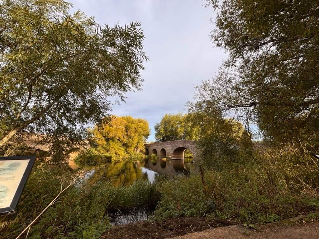
6.5 miles Distance Simple Navigation Biscuit Challenge rating Route summary An easy to navigate, pleasant walk through the Worcestershire countryside. This route can be split into two much shorter routes. Start: Pershore Bridges Picnic Place Finish: Pershore Bridges Picnic Place GPX part 1 GPX part 2 Getting to the start of the walk By Bus You can get a bus from Worcester or Evesham to the centre of Pershore By car You can park at Pershore Bridges Picnic Place About the walk This walk can be split into two smaller walks or completed as a whole. It’s ideal for those who don’t want to fully commit from the start. I recommend starting from Pershore town if you need to pick up refreshments or importantly, if you need to use the facilities before you head out – because there are none on route.  The whole route is very easy walking, with only the slightest gradient in part two which is incredibly brief and not at all strenuous. There are however two stiles making it not accessible to all. Part 1 If you are starting from Pershore town centre  Head straight out of the town centre on Bridge street – heading in the direction of Pershore College. You will pass a large field on your right with some finger posts – ignore this. Keep going until you get to the anti-tank defence blocks which are located at Pershore bridges – pass through here to pick up the tree-lined path which will be on your left after the bridge. If you’re starting from the car park Start at the small car park area and head towards the bridges. Take the path right before the bridge, through the kissing gate, and follow the pretty tree-lined path (Wick History Trail) to the gate at the other end.  Trail tip: Don’t cross the bridge Very shortly you will come to Yock lane – take a left here and walk up the lane. You will pass a couple of houses on your right on route. When you reach the end of the lane, it will fork – ignore the fork left – this is a farm entrance. Instead take the right fork, diagonally through the field to a stile.In the next field cut through the gap in the hedge and head right.  Trail tip: There is a young oak tree where the gap in the hedge is. Keep heading in this direction through several fields until you arrive at a farm. Pass through the gate to a lane and turn right. Walk a short way and you will come to a large barn on your right, turn right here and follow the wide path in the direction of the wooded area. Trail tip: In the summer months, you may be rewarded with fields of flowers here.These are the confetti flower fields owned by The Real Flower Petal Confetti Company. On approach to the wooded area, follow the path left through two fields, which will bring you back to a lane. Turn right here and then right again onto Main Street. Here you will pass St. Mary’s church. Ignore Timber Lane on your left, the road curves right and meets Yock’s Lane. You will soon see the path left and you can return to the car park via the tree-lined path. This marks the mid-way point of what is a figure of eight walk. If you’ve walked enough, you can stop here. If you haven’t, you have two options, depending on your energy levels, hunger pangs, or toilet needs.  Option 1: Head into Pershore for a toilet break and refreshments before returning to complete the second part of the walk. Option 2: Plough on and complete the whole walk before rewarding yourself. Part two  From the car park – this time head in the opposite direction, taking the underpass. Take the path left which brings you to a road – turn right here and ignore the road that goes off left. Turn right following signs for the Wychavon Way, crossing fields and a young orchard plantation towards Pensham.  Trail tip: Look to your right for a nice view of Pershore Abbey. At Pensham turn left heading down the house-lined lane towards Pensham farm. Walk pretty much as far as you can in this direction and then take the path left. You will see a sign for the Wychavon Way right but don’t take this. Instead go straight on towards the farm building. On approach to the farm, you’ll likely see a handy sign on a tree reminding you that the path here goes left. Take this and it will bear right through the middle of large crop fields. You will come to a track with a sign post to the right of you. Turn left here and follow the track a short way until you come to a property on your right. Trail tip: The footpath sign here is somewhat hidden behind greenery on your left, but it is there.  Follow the path with buildings to your right and horse paddocks to your left.Until you arrive at a road. Turn left here and look for the path on the other side of the road. Take this path, with pear trees on your right until you meet some woods. Here the path is more uneven, with inlaid rough wooden ‘steps’ in places. Follow the path until you meet the road. Cross here and follow the path back to the underpass, concluding your walk at the car park. If you started your walk in Pershore town, simply cross the bridge and retrace your steps back to town, which will be via Bridge Street on your right. Download PDF

Hikes near me: Pershore Read More »

Hikes near me: Badby

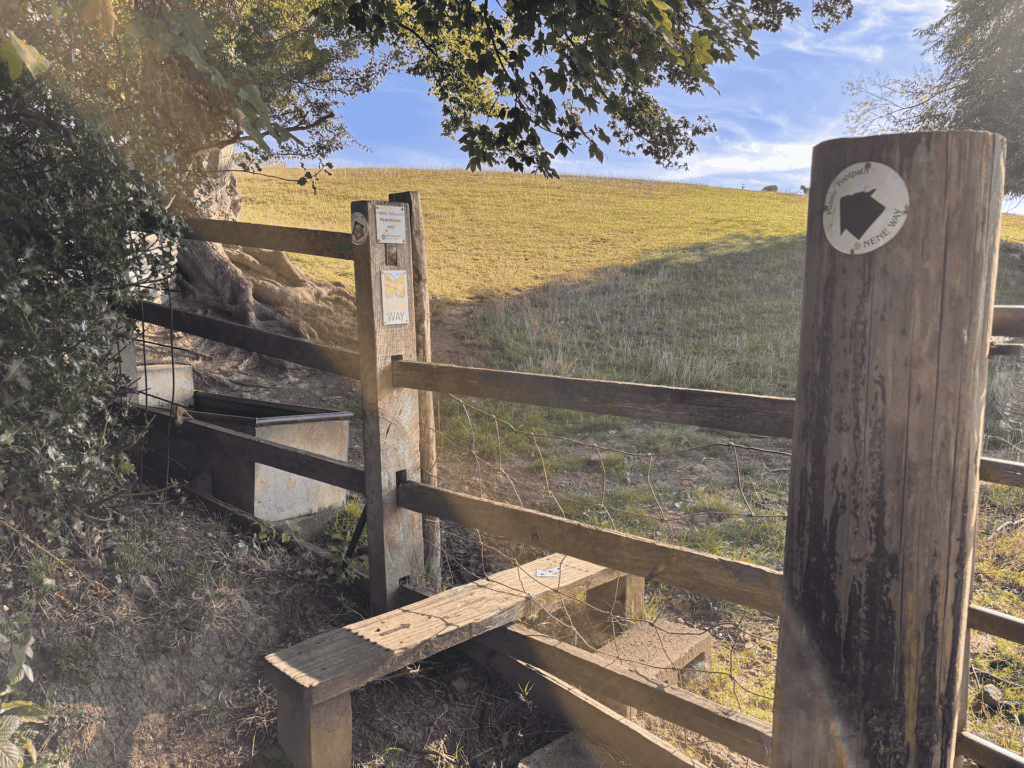
8.5 miles Distance Moderate Navigation Croissant icon Croissant Challenge rating Route summary Circular route through farm fields mostly. Quite a few stiles and footbridges to navigate. Takes some careful navigation when you’re not on the national trail parts of the route.  Start: Badby, Northamptonshire Finish: Badby, Northamptonshire GPX This walk starts at Court Yard Lane, where you will see a finger sign pointing left to Newnham via the Nene Way.    Take this lane. At the end, the lane splits. Ignore the farm gate on the right and head past the cottages on the left to a gate following the Nene Way. Head through the gate and pass through  2 fields, following this you will enter a third, large field. Stick with the path right following the hedge line with a stream, into a 4th field and through a gate to a road.   Turn right here heading into Newnham. Follow the main road through Newnham, taking a minute to admire the use of the old telephone box here which has some lovely historical images of the village and now acts as a mini library.   When you get to the end of the village, you will arrive at a junction. Bear right here. Ignore the road to your left ( Mounts Lane) and continue straight past the Nuttery. Follow signs for the Nene Way to cross a stile into a field.   Head for the telegraph post in the middle of the field, which helpfully has waymarkers attached. Cross into the next field and walk about half way in the current direction. Here you are at a path intersection – head right and through the gate to the next field.    From here take a slight diagonal left heading in the direction of the field corner to the livestock barrier footbridge. Take this into the next field and continue diagonally again, to a gate left of centre.   Keep on in this direction to a gate in the corner left of the field and again continue diagonally to a field gate. Once through this, head corner right between the trees to emerge into a large field.    Head slight diagonally left toward the farm building. You should see Everdon Hall to your left. Exit through a gate and down a few stone steps into Little Everdon and take the lane slightly left in front of you.   Ignore the path for the Nene Way that goes off left shortly and stick with the lane into Everdon. When you get to the end of the lane, go right and immediately left, heading towards the church. The path that you want runs to the right of the Church and emerges into a field behind College farm. Keep the farm buildings to your right and head past them to the gate.   Cross the next field to the gate opposite and enter the next field. Cross diagonally uphill heading towards the semi-collapsed farm building ( note this is in process of being refurbished and may in the future be a house).   With the farm building on your right, follow the hedge line to your left through several fields. Note that the boundary will shift from your left to your right. Eventually you will reach the outer corner of a field to your right. The path here may not be clear, but keep on in the same direction heading towards and past a tree centre field.   The way continues through the hedge and left to a gap in the hedge in the near field corner, which at the time of writing was a little overgrown and hard to spot.   Cross this field diagonally to arrive at a track. Cross the track slightly to your right and cross the stream a long field. Keeping the wooded field boundary to your right, keep on to the end of the field, where you will pass through a small wooded area into another field.    Cross this field diagonally left heading to approximately mid point opposite. Once through here – head again diagonally left, uphill to the field corner to arrive at the road into Preston Capes.    Take a right here, taking care on the road and walk slightly downhill to the bend in the road. Here, take the Knightly Way path on your left into the field and head right at a slight left diagonal to the gate into another field. Keep in the same direction and cross two fields following the path in the middle.   Entering the next field, the path may not be clear. It’s best to simply follow the field boundary to your left, which will turn a corner right and you will see the gate on the left. Take this and then enter the field ahead, taking the path right through open fields heading in the direction of Big Waters.   Pass the church and Fawsley Hall on your left and from the lane, take the small gate on your left sticking with the Knightly Way through 2 fields and across Fawsley Park. Continue on the Knightly Way following the path on the internal perimeter of Badby Wood.  You will emerge from the wood into a green field. Cross this diagonally to enter a pretty green field. Stick the the left boundary here and look for the gate somewhat hidden on your left. Take this and follow the narrow path back into Badby, where you’ll come out at the church where you can take a slight right and then a left turn to arrive at Main Street. Take a right onto Main street and follow the road back to the starting point. Download PDF

Hikes near me: Badby Read More »