The way out hikes

Hikes in the UK

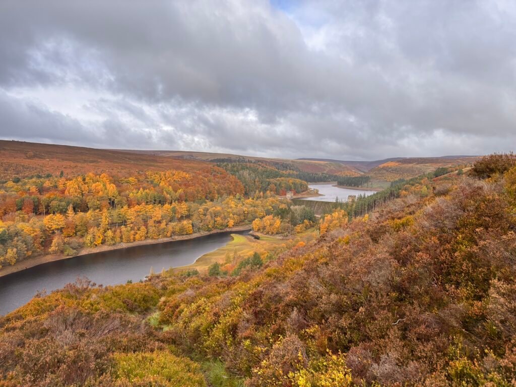
Hikes near me: Bamford & Ladybower

Hikes near me: Bamford & Ladybower 6.4 miles Distance Moderate Navigation burrito icon Burrito Challenge rating Route summary This hike combines gentle walking on well established paths with some more challenging moorland walking. The hike starts off gently with a walk along the east shore of Upper Derwent Reservoir. After this, you gain elevation and the great views over the Upper Derwent Valley open up.   Start and finish: Fairholmes car park Head NE towards the Derwent Dam from the car park. You will be on an unclassified road. As the road rounds a bend, look for a small footpath rising through a wooded area to your left (not the first trail path).   This path climbs gently to a bridleway. Turn left here and follow the track past the dam for approximately 3 km. The track is easy and this is a pretty walk on good ground.    You’re looking for a path on the right. If you reach a bridge, you’ve gone a little too far. You should see a very clear path. Take this and after around 40 yds look to the right of this, you should see a more faint path rising quite sharply through the trees in a southerly direction. This is the path you want.     After a short climb, you’ll go through a gate to enter the open access land. Continue rising diagonally. Continue SE with the boundary wall to your right. At around the km mark, you should cross a boundary wall. Continue on passing through another boundary wall.   Ignore the path you see to the left and continue SE past the cairns and through another boundary wall until you see a wide track heading off diagonally left and the outer corner of a field wall boundary.     Continue ahead on the track. You should have a small wooded area visible ahead of you slightly left. Enter the field to the right of this wooded area and take the path on the right to a gate.   Once through the gate, ignore the paths left and right and take the track forward with the boundary wall to your right.   This track will curve to the left and you’ll start to lose elevation. Follow the clear track down. Ignore when this track splits off to the left. Instead enter the field on your right and, keeping the wall to your left, handrail this to a gate.   Go through the gate and continue your descent back to the bridleway.   Turn right and head back towards the dam, where you can retrace your steps on the wooded path or take the steps down and return to the car park which has a takeaway cafe, picnic benches, and toilet facilities.

Hikes near me: Bamford & Ladybower Read More »

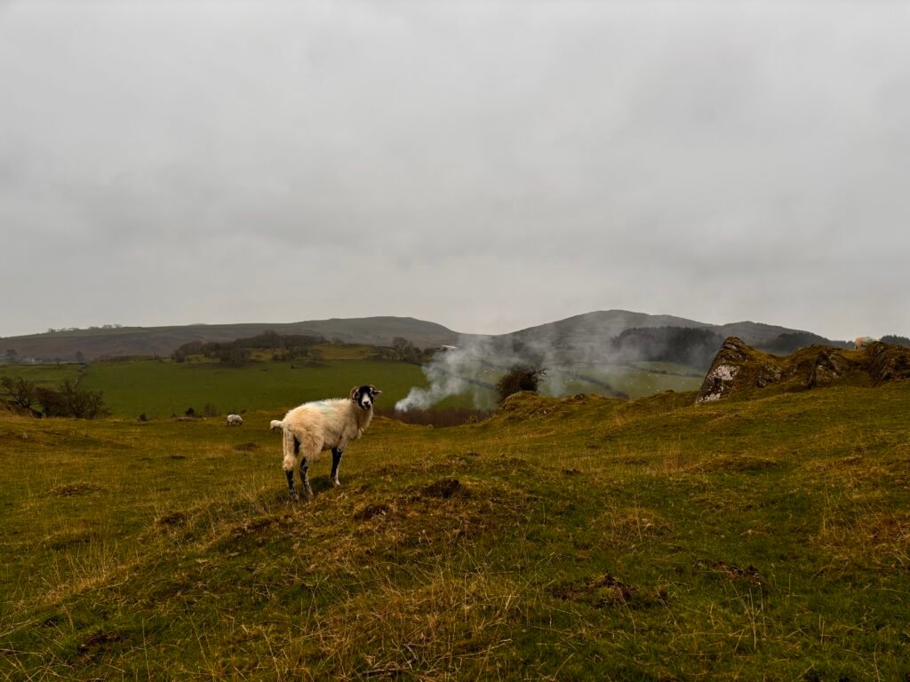
a sheep in a field

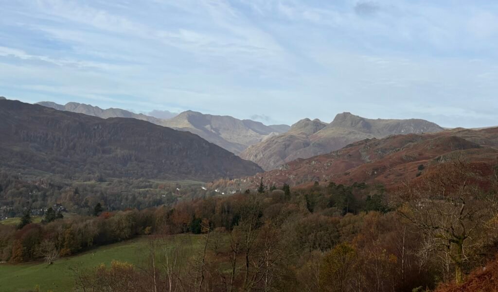
Hiking the Cumbria Way in 7 days

Hiking the Cumbria Way in 7 days 73 miles Distance Moderate Navigation roast dinner icon Full roast Challenge rating While there are some stages of the Cumbria Way that really cannot be shortened, it is possible to take a more leisurely pace on others. Hiking the Cumbria Way over 7 days can make for a wonderfully relaxed week of hiking in some spectacular scenery.    Navigation on the route is described at moderate as much of the route is well way-marked and straightforward. However, some sections, in particular stage one can be more challenging. This itinerary is based on the regular Cumbria Way route. Other routes are available, such as the mountain route and stage six in particular has an official foul weather alternative route option.    Most of us that love hiking rarely just hike on through without pausing to take pictures or admire the view, so as with any distances, it’s important to factor this as well as a missed turn buffer into plans.    Other factors are terrain and ascent. A 6-mile day might seem light, but when you factor in steep ascents and descents over uneven rocky ground, often it’s enough. 7-day itinerary Day One: Ulverston to Coniston (15.5 miles) Day Two: Coniston to Skelwith Bridge (6.3 miles) Day Three: Skelwith Bridge to Great Langdale (5.5 miles) Day Four: Great Langdale to Stonethwaite (7.3 miles) Day Five: Stonethwaite to Keswick (9.3 miles) Day Six: Keswick to Caldbeck (14.5 miles) Day Seven: Caldbeck to Carlisle (15.5 miles) The Cumbria Way starts at The Gill in Ulverston and day one’s hiking is through farms and fields, and over moorlands.  Depending on the time of year, this stretch of the route can be very quiet. That’s worth considering if you are hiking alone.   Navigation is mostly straightforward, but some signage can be a bit elusive, especially in the section between Newbiggen and Beacon Tarn. The final stretch of the day follows Coniston Water into the village of Coniston in the shadow of the Old Man for your first overnight stop.   Day two starts with a steep climb out of Coniston but on the whole is a gentler hike. Official route books have you walk to Great Langdale, but on this itinerary, you will stop at Skelwith Bridge. This gives you the freedom to really take your time today, in contrast to yesterday’s walking.   You’ll walk via Tarn Hows, you can take a detour to Colwith Force if you want to and once you hit Skelwith, you also have the opportunity to go take a look at Skelwith Force.  Heck, if you really have too much energy left at the end of the day – you can even hoof it up the lane behind the Skelwith Bridge Hotel to get a view of Loughrigg Tarn.   Day three is another easy-going day.  You can take your time over breakfast – there is no rush today and there are plently of places to stop for lunch on route today also, so no need to pack a lunch unless you really want to. If you’re an early bird, you could hoof it up to catch the sunrise over Loughrigg Tarn.   Leaving Skelwith, you follow the Cumbria Way first to Elterwater, then Chapel Stile, and onto Great Langdale. Today is the day you start to see some truly wonderful scenery as you approach Great Langdale.   After a restful night at Great Langdale, which has several accommodation options – pick up the Cumbria Way again behind Old Dungeon Ghyll.     Today is a fantastic day’s walking if the weather is good.  If the weather is bad – well, that’s a different story and if the weather is really foul with significant rainfall – you might want to consider how committed you really are to hiking this day because on a good day, you will cross streams. On a bad day – you will be wading through them. Don’t say you weren’t warned!   The day itself is not especially long, but it is quite tiring with the steep ascent and descent of Stake Pass to negotiate.  You can overnight in Stonethwaite or Rosthwaite.     Day five takes you through the spectacularly mossy greens of Borrowdale and follows the left shore of  Derwentwater all the way to Keswick.   You could easily be in Keswick for lunch if you head out early and today’s walking is pretty gentle. You can deviate from the path of course and join the throngs climbing Catbells. Or, you can take it easy, stop off at Lingholm for a leisurely lunch and then enjoy some time in Keswick, which has an abundance of shops, pubs, and restaurants; not to mention the largest pencil in the world.    Day six is a long hike and it starts with a steep climb out towards Latrigg.  The walking today is sublime though – particularly if the weather is good.    You’ll have lovely views of Blencathra on your right syou head towards Skiddaw House, which is a great place to stop for a break. There is an honesty kitchen here, where  (at the time of writing) you can make yourself a proper cuppa – and if the weather is bad or cold – you should definitely take advantage of this cosy option and warm up before the next stretch.    You’ll have a choice to make at this point. Follow the foul weather route left if it’s bad, or, if it’s fine, continue on the regular route right.      You will come to a left turn over a footbridge and will reach the old mines – you should be able to see the Lingy hut high up on the hill. You are heading towards this.   After the mines, the going gets much more rocky underfoot and the path can be difficult to keep track of. Just for fun – this is where you will encounter peat hags as well.    After the Lingy hut, you’ll

Hiking the Cumbria Way in 7 days Read More »

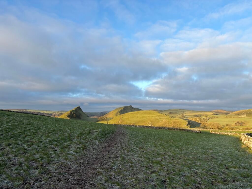
Weekend hikes: Bakewell and Chrome Hill

Bakewell & Chrome Hill What’s more enjoyable than a weekend escape that combines great hiking, great beer, and a few choice shops to spoil yourself with some new outdoor wear?    One of our top picks is a weekend that combines an overnight in Bakewell, Derbyshire with a super exciting scramble on Chrome Hill. You can arrive on day one and stretch your legs with an easy few hours on the Monsal Trail, fit in a bit of gear shopping in town, and spend a pleasant evening in Bakewell before getting some serious hiking in on day two.   Day one – Bakewell and The Monsal Trail   After arriving in Bakewell, find your way to the Monsal Trail which you can pick up at Station Road. The Monsal Trail is an 8.5 mile, fully accessible trail that follows the old railway line.   There’s no need for any complex navigation – just follow the trail as far as you feel like, remembering that you have to get back to Bakewell at some point.   It’s a pleasant, easy-going walk with refreshments and facilities along the way. It serves as a nice warm up to stretch the leg muscles and get you ready for something a little heartier on day two.    Day two – Parkhouse and Chrome hill   After a good night’s sleep, head over Earn Sterndale by car or take a bus and follow the signed path to Parkhouse Hill.   You have a choice here. You can stick to the low route (recommended if the weather is bad or icy) and head right around Parkhouse hill, or…. you can go up and over.    The steep route up will fill your lungs and you’ll have some scrambling to do to get over and back down the other side. Nothing too bonkers, but hands-on for sure and the descent is more challenging than the ascent. The views are great and it’s an exciting hike.   Next up is Chrome Hill, where again – you can tackle the short ridge or you can stay low and avoid it. It all depends on the weather (stay safe) and how you feel about exposed ridges.    If you have limited time, you can turn around after Chrome hill and make your way back – if you have a bit more leisure time (and a map), you can extend your walk heading out towards Stoop Farm, creating a circular route that takes you through Hollinsclough.

Weekend hikes: Bakewell and Chrome Hill Read More »

3 Days in the Lake District: A Challenging Hike from Ulverston to Bowness-on-Windermere

30 miles Distance Moderate Navigation roast dinner icon Full roast Challenge rating Route summary A three-day Lake District adventure via Coniston, Skelwith Bridge and Loughrigg Fell   For the adventurous — and those who don’t mind muddy boots.   Fancy three days of proper walking in the Lake District? This point-to-point adventure takes you from Ulverston to Coniston, on to Skelwith Bridge and over Loughrigg Fell to Ambleside, before finishing with a ferry ride across Windermere to Bowness-on-Windermere.   Expect beautiful scenery, quiet stretches of countryside, challenging terrain and plenty of reasons to stop for a snack. You’ll also encounter stiles, muddy paths and the occasional climb that makes you question your life choices — briefly, of course.   This is a challenging multi-day hike, best suited to walkers who are comfortable with long days on varied terrain and confident navigating independently. Good preparation is essential, but the rewards are well worth the effort.   One of the best things about this route is that you don’t have to walk every last mile. You’ll follow sections of the Cumbria Way before finishing on the water, making this a lovely combination of walking, scenery and a little time to put your feet up.   Just don’t expect three days of gentle lakeside strolls. This is the Lake District, after all! Before You Set Off Is This Hike for You? This is a challenging three-day adventure that requires a good level of fitness, confident navigation and a willingness to tackle uneven, rocky and sometimes boggy terrain. It’s rewarding, but it’s not the route to choose if you’re looking for a gentle introduction to multi-day hiking.   Plan Your Arrival Day One is a long walk. If you’re travelling a fair distance to Ulverston, arriving the day before is well worth considering. It gives you time to settle in, get a good night’s sleep and start the first walking day feeling refreshed rather than already in need of a sit-down.   If you’re local and can easily reach the start of the route, you may not need to stay overnight.   Check the Daylight The time of year matters. In autumn and winter, shorter daylight hours can make a long walking day more challenging. Plan an early start, check sunset times and carry a headtorch. If you’re walking after the clocks go back, aim to be ready to set off by 8 am.   Pack for the Lakes Rain in the Lake District? Surely not! Joking aside, wet weather can turn paths muddy and leave peat bogs particularly soggy. Proper walking boots with good grip and ankle support, waterproof clothing and enough food and water are essential. There are no refreshment stops on Day One, so you’ll need to carry what you need.   Take a Map Much of this route follows the Cumbria Way, so the Harvey Maps Cumbria Way map could be a useful addition to your kit. It’s designed specifically for the trail and is waterproof, which is always welcome in the Lakes. And who knows? You might enjoy it enough to come back and walk the rest of the route. Day Zero – Arrival in Ulverston Where to stay in Ulverston You may find cheaper accommodation on the outskirts of town, but remember that every extra mile you walk before the official route even begins is a mile you didn’t need to do! The closer you are to the start of the route, the easier your day will be tomorrow and there is some accommodation right by the official start of the route.   What to do in Ulverston For something to do before your adventure begins, we’d head straight to the Laurel and Hardy Museum. Trust me when I say there’s no place quite like it — and it’s a wonderfully quirky way to start your Lake District trip.   Day One – Ulverston to Coniston via the Cumbria Way Ready to stretch those legs? Day One takes you from Ulverston to Coniston along the Cumbria Way, and it’s quite an introduction to your three-day adventure. Expect peaceful countryside, plenty of stiles, some tricky terrain and a few moments when you might wonder just how much further there is to go! It’s a beautiful route, but don’t underestimate it. A little preparation will go a long way towards making sure you finish the day with a smile on your face (and enough energy left to find the pub).   What to Expect Along the Way   A few farmyard friends The first half of the route takes you through farmland, so don’t be surprised if you find yourself sharing the path with some curious cows or sheep. Be respectful of livestock, follow any field signs and remember to leave gates as you find them. The animals live here, after all — you’re just passing through!   Peace, quiet and plenty of your own company Depending on the time of year, you might not see another soul for quite some time. You may not encounter many other walkers until you get closer to Beacon Tarn, so enjoy the peace and quiet. Think of it as a chance to switch off, soak up the scenery and have a good chat with yourself if you fancy it!   Stiles, stones, and squelchy bits There are plenty of stiles to negotiate on this route, so get ready for a day of climbing over things rather than simply walking around them. The terrain is varied, with uneven, rocky paths and some marshy ground around Beacon Tarn. After wet weather, things can get particularly muddy underfoot.   Good walking boots with ankle support and decent grip are strongly recommended. Your favourite trainers might look the part, but this probably isn’t their moment to shine. Navigation can also be tricky in places, so keep checking your position as you go. Even experienced walkers can get caught out when the path becomes less obvious.   The Coniston Water tease When you spot the sign for

3 Days in the Lake District: A Challenging Hike from Ulverston to Bowness-on-Windermere Read More »

Hikes near me: Chipping Campden to Broadway

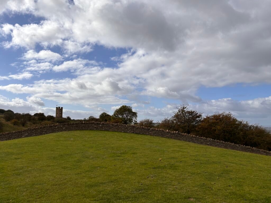
6 miles Distance Simple Navigation Biscuit Challenge rating Route summary This route is officially stage one of the Cotswolds Way National Trail which starts in Chipping Campden and ends in Bath. It’s an easy walk with great views and you can easily follow the official Cotswolds Way signs.   GPX  Start: Market Hall, Chipping Campden Finish: Broadway Village   Buses run into Chipping Campden from surrounding towns. There is free parking on the street and a paid car park in town, but be aware this is limited to 2 hours.    Start the route at the old market hall on High Street where you see the official Cotswold way plaque. Looking at the plaque, with the old market on your left – head south (to your right) and follow the road until you get to the Catholic Church on the corner.   Turn right at the church and head up the street until you reach a triangular junction with a large  wooden sign post – here head into Hoo Lane. Continue uphill here until you meet a lane (Kincombe Lane).    Turn left, cross the road and take the path enclosed with hedges on your right shortly. Go through the gate to Dover’s hill. Turn left into the meadow There is a topograph and a memorial stone in this meadow and some lovely views. It’s well worth a little lingering and there are some benches to sit on and enjoy the views on a clear day.    You’ll see a carpark, go through the gate into this and out the otherside, taking the path that runs parallel to the road on the left.   Pass through several fields keeping the hedge and road to your right and then exist via the gate in the corner right.    Cross the road on your left to the clear, wide path on the other side. This path runs behind the hedge. Keep on this path until you get to a stone stile.    Cross the stile and bear left and then right. The way here is very obvious. Keep on in this direction – passing through a gap in the wall and heading to a second wall.    Keep on in this direction across the field until you arrive at a road ( Buckle street).   Cross buckle street and cross the stile opposite into a field. Keep heading in the same direction and you will reach the outer edge of a picnic area.    To your right are a few stone steps with a memorial stone / Topograph (worth a little look). You need to head left though, through the picnic area.    This is a nice place to take a break if you have brought your own flash and snack with you and there are toilets here also.   From here – cross the road and turn right, following a broad rack that runs to the left of the road. You will soon reach a footpath through the edge of the woods. Follow this to emerge into a meadow.    Cross the meadow and bear left. You should now see Broadway tower up ahead – you’re heading towards this.   You can access the tower by going through the iron gate. At the tower, the views again are big.  There is one bench here if you require a little sit down. Or, if you are not ready to descend into Broadway yet – you can detour slightly here and continue past the tower to a cafe.    Once you’re ready, exit the tower through the same gate that you came in. Take a left and follow the path down with the hedge on your right and the tower on your left.   From here the way is very easy – just keep heading downhill in the same direction and follow Cotswolds Way signs to Broadway. You will emerge into a small lane between houses. From here, turn left and follow the road onto the High street where there are plenty of shops, pubs, and cafes.    Note, this is an A to B walk – so you’ll need to either turn around and retrace your steps to Chipping Campden  – making this a hoof of a walk (and uphill to the tower) Or, you can catch a bus back to Chipping Campden from outside the Lygon Arms. Download PDF

Hikes near me: Chipping Campden to Broadway Read More »

Hikes near me: Edge Hill

6.5 miles Distance Simple Navigation Biscuit Challenge rating Route summary Circular route overlooking the site of the Battle of Edge Hill. Pretty easy going, but boots are recommended due to the rocky woodland paths.  Start: Ratley, Banbury Finish: Ratley, Banbury GPX   Getting to the start of the walk   By bus Buses do run to Ratley from Leamington Spa, Banbury, and Stratford upon Avon   By Car You can park at Town Hill   About this walk Ratley From Town Hill, you want to head up Old road past the houses to meet the B4086. Cross the road and take the path slightly left of the junction. Take the steps down, sign posted the Centenary / Macmillan Way.   At the bottom of the steps, turn left, ignoring the kissing gate in front of you. Very shortly, again, take the rocky left hand path, following the Macmillan Way / public bridleway.   Keep on in this direction until you emerge at a road. Turn left here and very shortly cross the road to take the wide track. After a short while, you will come to a track between paddocks on your right. Take this and then continue straight ahead following the wooded path.   This is a pleasant stretch of the walk which brings you to Spring Hill, where you can enjoy some wonderful views on a clear day. If you’ve timed it just right and the weather is fair, this is a great spot for a lunch break.   The patchwork of fields are quite stunning and if you’ve a creative bent, it would make for a great place to do some sketching or watercolouring. It also happens to look out over what is reported to be the site of the Battle of Edge Hill, where King Charles’ forces (the Cavaliers) met the parliamentarians (Roundheads) in battle.   Ignore the stile leading into the field to your left and continue straight for a short while longer until you see a multi-signed gate left into a field. Go through this gate and walk diagonally through the middle of this long field.   Cross the lane into another field and continue in this same direction through two more fields past Sugarswell cottages heading toward Home farm.   Bear right following the path and then left through a gate where you will see some old brick buildings and a rather interesting looking buttressed wall to your right.   Keep ahead now until you reach Upton House parking. With the car park to your left, follow the drive to the road. Turn right here, cross the road and take the lane on your left.    There is no pedestrian path on this lane, so take care here although it is not a busy road. Continue on the lane until you arrive at a junction, turn left here and continue until you meet the B4086.    Turn right here to arrive at the Castle Inn, a great spot for lunch or a refreshment break.   Having replenished your energy, you have a choice or routes at this point.   Option 1: turn left out of the pub and then take the path immediately left and then right to retrace your steps to emerge at Ratley.   Option 2: turn left out of the pub, cross the road and take the waymarked path behind the cottage to the left of the pub car park. The initial path is enclosed with a fence to the right and emerges onto a road.    Turn right here, cross the road and take the path left. Follow this until you meet an opening to a large field. The path you want is just before this field to the left. At the time of writing, the stile here was in pretty bad shape, but cross this and with the hedge to your right head to the corner and following this, then head left towards the gate with the farm in view beyond this.    The path here is not clear and also overgrown. You don’t want to go through the farm, so instead, if the path remains overgrown, scramble slightly left of this and you will soon see a step in the corner wall, which will bring you to a drive.    Take this and follow it up to the road, where you want to turn left walking a short way to arrive back at your starting point, Town Hill to your right. Download PDF

Hikes near me: Edge Hill Read More »

Hikes near me: Pershore

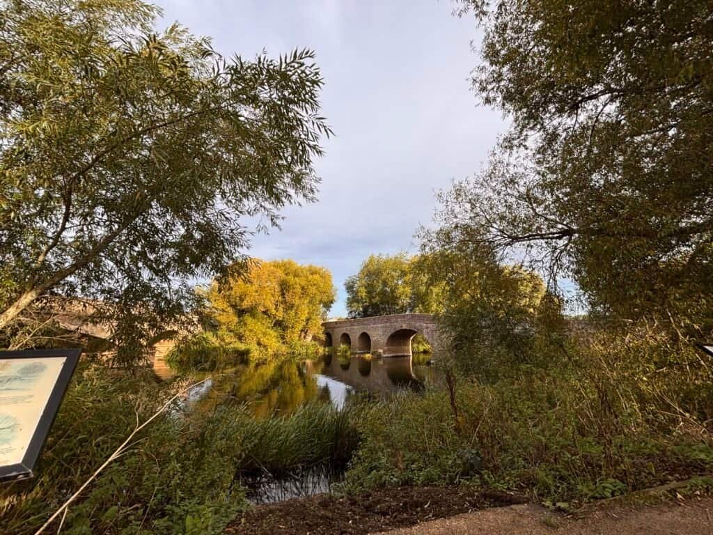
6.5 miles Distance Simple Navigation Biscuit Challenge rating Route summary An easy to navigate, pleasant walk through the Worcestershire countryside. This route can be split into two much shorter routes. Start: Pershore Bridges Picnic Place Finish: Pershore Bridges Picnic Place GPX part 1 GPX part 2 Getting to the start of the walk By Bus You can get a bus from Worcester or Evesham to the centre of Pershore By car You can park at Pershore Bridges Picnic Place About the walk This walk can be split into two smaller walks or completed as a whole. It’s ideal for those who don’t want to fully commit from the start. I recommend starting from Pershore town if you need to pick up refreshments or importantly, if you need to use the facilities before you head out – because there are none on route.  The whole route is very easy walking, with only the slightest gradient in part two which is incredibly brief and not at all strenuous. There are however two stiles making it not accessible to all. Part 1 If you are starting from Pershore town centre  Head straight out of the town centre on Bridge street – heading in the direction of Pershore College. You will pass a large field on your right with some finger posts – ignore this. Keep going until you get to the anti-tank defence blocks which are located at Pershore bridges – pass through here to pick up the tree-lined path which will be on your left after the bridge. If you’re starting from the car park Start at the small car park area and head towards the bridges. Take the path right before the bridge, through the kissing gate, and follow the pretty tree-lined path (Wick History Trail) to the gate at the other end.  Trail tip: Don’t cross the bridge Very shortly you will come to Yock lane – take a left here and walk up the lane. You will pass a couple of houses on your right on route. When you reach the end of the lane, it will fork – ignore the fork left – this is a farm entrance. Instead take the right fork, diagonally through the field to a stile.In the next field cut through the gap in the hedge and head right.  Trail tip: There is a young oak tree where the gap in the hedge is. Keep heading in this direction through several fields until you arrive at a farm. Pass through the gate to a lane and turn right. Walk a short way and you will come to a large barn on your right, turn right here and follow the wide path in the direction of the wooded area. Trail tip: In the summer months, you may be rewarded with fields of flowers here.These are the confetti flower fields owned by The Real Flower Petal Confetti Company. On approach to the wooded area, follow the path left through two fields, which will bring you back to a lane. Turn right here and then right again onto Main Street. Here you will pass St. Mary’s church. Ignore Timber Lane on your left, the road curves right and meets Yock’s Lane. You will soon see the path left and you can return to the car park via the tree-lined path. This marks the mid-way point of what is a figure of eight walk. If you’ve walked enough, you can stop here. If you haven’t, you have two options, depending on your energy levels, hunger pangs, or toilet needs.  Option 1: Head into Pershore for a toilet break and refreshments before returning to complete the second part of the walk. Option 2: Plough on and complete the whole walk before rewarding yourself. Part two  From the car park – this time head in the opposite direction, taking the underpass. Take the path left which brings you to a road – turn right here and ignore the road that goes off left. Turn right following signs for the Wychavon Way, crossing fields and a young orchard plantation towards Pensham.  Trail tip: Look to your right for a nice view of Pershore Abbey. At Pensham turn left heading down the house-lined lane towards Pensham farm. Walk pretty much as far as you can in this direction and then take the path left. You will see a sign for the Wychavon Way right but don’t take this. Instead go straight on towards the farm building. On approach to the farm, you’ll likely see a handy sign on a tree reminding you that the path here goes left. Take this and it will bear right through the middle of large crop fields. You will come to a track with a sign post to the right of you. Turn left here and follow the track a short way until you come to a property on your right. Trail tip: The footpath sign here is somewhat hidden behind greenery on your left, but it is there.  Follow the path with buildings to your right and horse paddocks to your left.Until you arrive at a road. Turn left here and look for the path on the other side of the road. Take this path, with pear trees on your right until you meet some woods. Here the path is more uneven, with inlaid rough wooden ‘steps’ in places. Follow the path until you meet the road. Cross here and follow the path back to the underpass, concluding your walk at the car park. If you started your walk in Pershore town, simply cross the bridge and retrace your steps back to town, which will be via Bridge Street on your right. Download PDF

Hikes near me: Pershore Read More »

Hikes near me: Badby

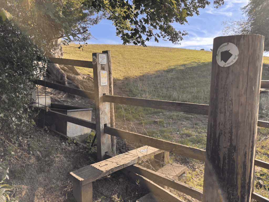
8.5 miles Distance Moderate Navigation Croissant icon Croissant Challenge rating Route summary Circular route through farm fields mostly. Quite a few stiles and footbridges to navigate. Takes some careful navigation when you’re not on the national trail parts of the route.  Start: Badby, Northamptonshire Finish: Badby, Northamptonshire GPX This walk starts at Court Yard Lane, where you will see a finger sign pointing left to Newnham via the Nene Way.    Take this lane. At the end, the lane splits. Ignore the farm gate on the right and head past the cottages on the left to a gate following the Nene Way. Head through the gate and pass through  2 fields, following this you will enter a third, large field. Stick with the path right following the hedge line with a stream, into a 4th field and through a gate to a road.   Turn right here heading into Newnham. Follow the main road through Newnham, taking a minute to admire the use of the old telephone box here which has some lovely historical images of the village and now acts as a mini library.   When you get to the end of the village, you will arrive at a junction. Bear right here. Ignore the road to your left ( Mounts Lane) and continue straight past the Nuttery. Follow signs for the Nene Way to cross a stile into a field.   Head for the telegraph post in the middle of the field, which helpfully has waymarkers attached. Cross into the next field and walk about half way in the current direction. Here you are at a path intersection – head right and through the gate to the next field.    From here take a slight diagonal left heading in the direction of the field corner to the livestock barrier footbridge. Take this into the next field and continue diagonally again, to a gate left of centre.   Keep on in this direction to a gate in the corner left of the field and again continue diagonally to a field gate. Once through this, head corner right between the trees to emerge into a large field.    Head slight diagonally left toward the farm building. You should see Everdon Hall to your left. Exit through a gate and down a few stone steps into Little Everdon and take the lane slightly left in front of you.   Ignore the path for the Nene Way that goes off left shortly and stick with the lane into Everdon. When you get to the end of the lane, go right and immediately left, heading towards the church. The path that you want runs to the right of the Church and emerges into a field behind College farm. Keep the farm buildings to your right and head past them to the gate.   Cross the next field to the gate opposite and enter the next field. Cross diagonally uphill heading towards the semi-collapsed farm building ( note this is in process of being refurbished and may in the future be a house).   With the farm building on your right, follow the hedge line to your left through several fields. Note that the boundary will shift from your left to your right. Eventually you will reach the outer corner of a field to your right. The path here may not be clear, but keep on in the same direction heading towards and past a tree centre field.   The way continues through the hedge and left to a gap in the hedge in the near field corner, which at the time of writing was a little overgrown and hard to spot.   Cross this field diagonally to arrive at a track. Cross the track slightly to your right and cross the stream a long field. Keeping the wooded field boundary to your right, keep on to the end of the field, where you will pass through a small wooded area into another field.    Cross this field diagonally left heading to approximately mid point opposite. Once through here – head again diagonally left, uphill to the field corner to arrive at the road into Preston Capes.    Take a right here, taking care on the road and walk slightly downhill to the bend in the road. Here, take the Knightly Way path on your left into the field and head right at a slight left diagonal to the gate into another field. Keep in the same direction and cross two fields following the path in the middle.   Entering the next field, the path may not be clear. It’s best to simply follow the field boundary to your left, which will turn a corner right and you will see the gate on the left. Take this and then enter the field ahead, taking the path right through open fields heading in the direction of Big Waters.   Pass the church and Fawsley Hall on your left and from the lane, take the small gate on your left sticking with the Knightly Way through 2 fields and across Fawsley Park. Continue on the Knightly Way following the path on the internal perimeter of Badby Wood.  You will emerge from the wood into a green field. Cross this diagonally to enter a pretty green field. Stick the the left boundary here and look for the gate somewhat hidden on your left. Take this and follow the narrow path back into Badby, where you’ll come out at the church where you can take a slight right and then a left turn to arrive at Main Street. Take a right onto Main street and follow the road back to the starting point. Download PDF

Hikes near me: Badby Read More »